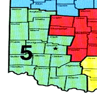
Southwest Ohio Fishing Lake Maps - Region Five(5)
Find your Southwest Ohio lake and reservoir fishing maps on gofishohio. Topographic lake maps, boat ramps locations and boating info, local area weather. Ohio Division of Wildlife Offices are listed below. Please contact them with any concerns or comments that you may have concerning your favorite lakes – they are here to help.
Click the Lake Name for info & local weather. Help Support & Preserve the Great Ohio Outdoors!
Acton Lake Fishing Map
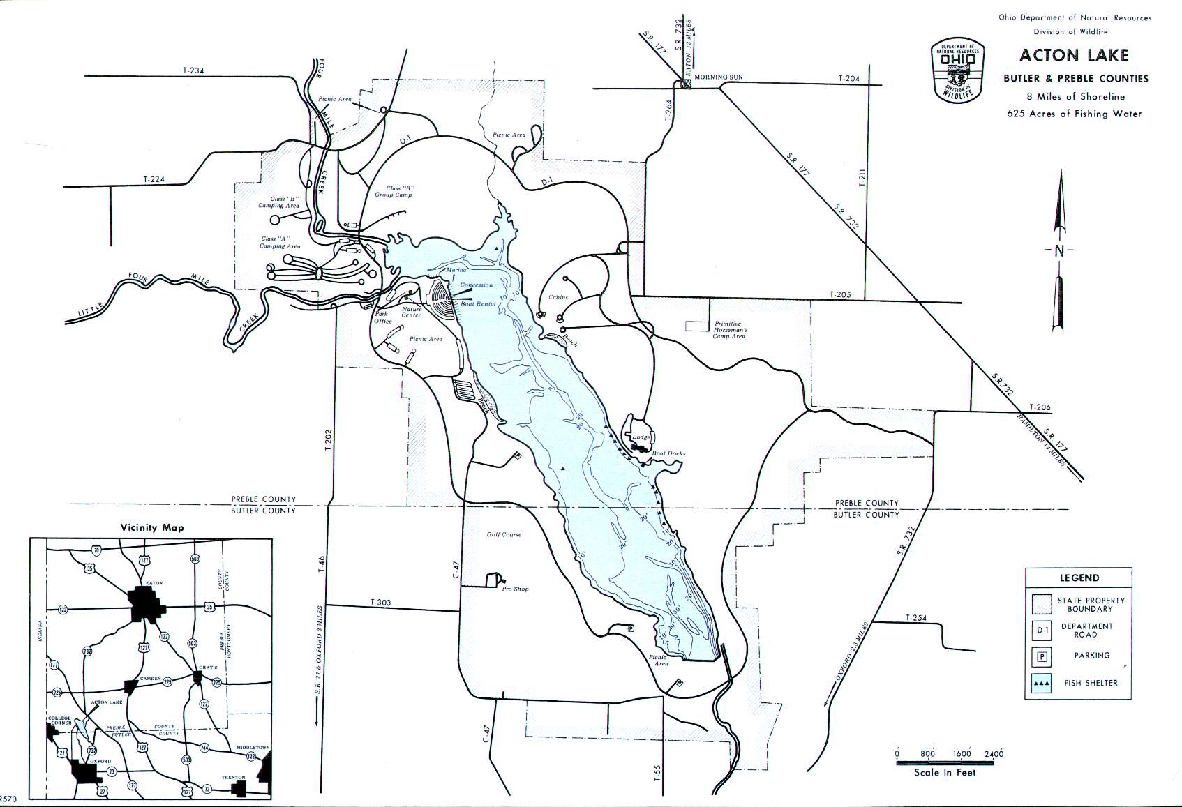 5.625 acres
10-hp limit
Caesar Creek Lake Fishing Map
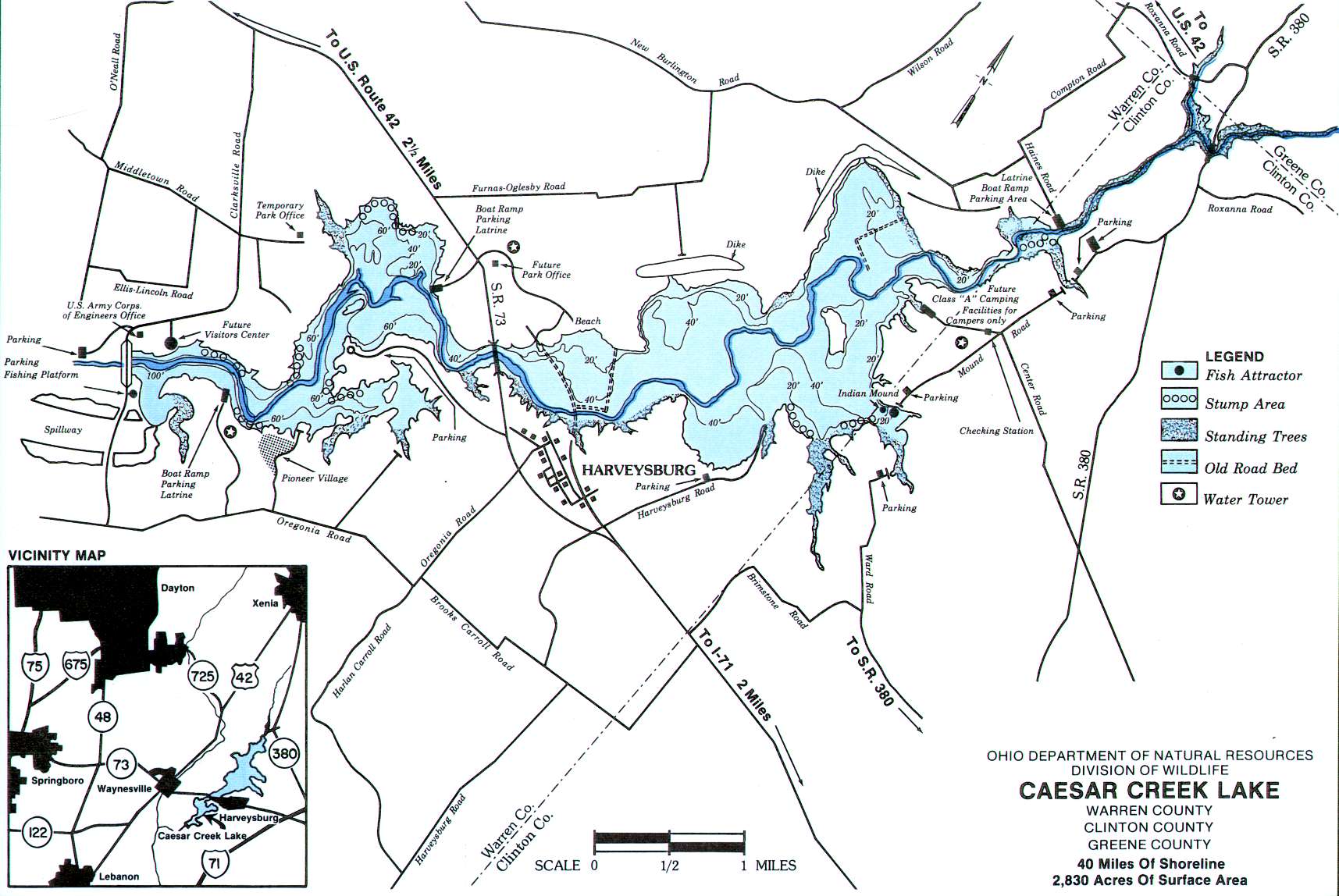 2830 acres
Unlimited HP
CJ Brown Reservoir Fishing Map
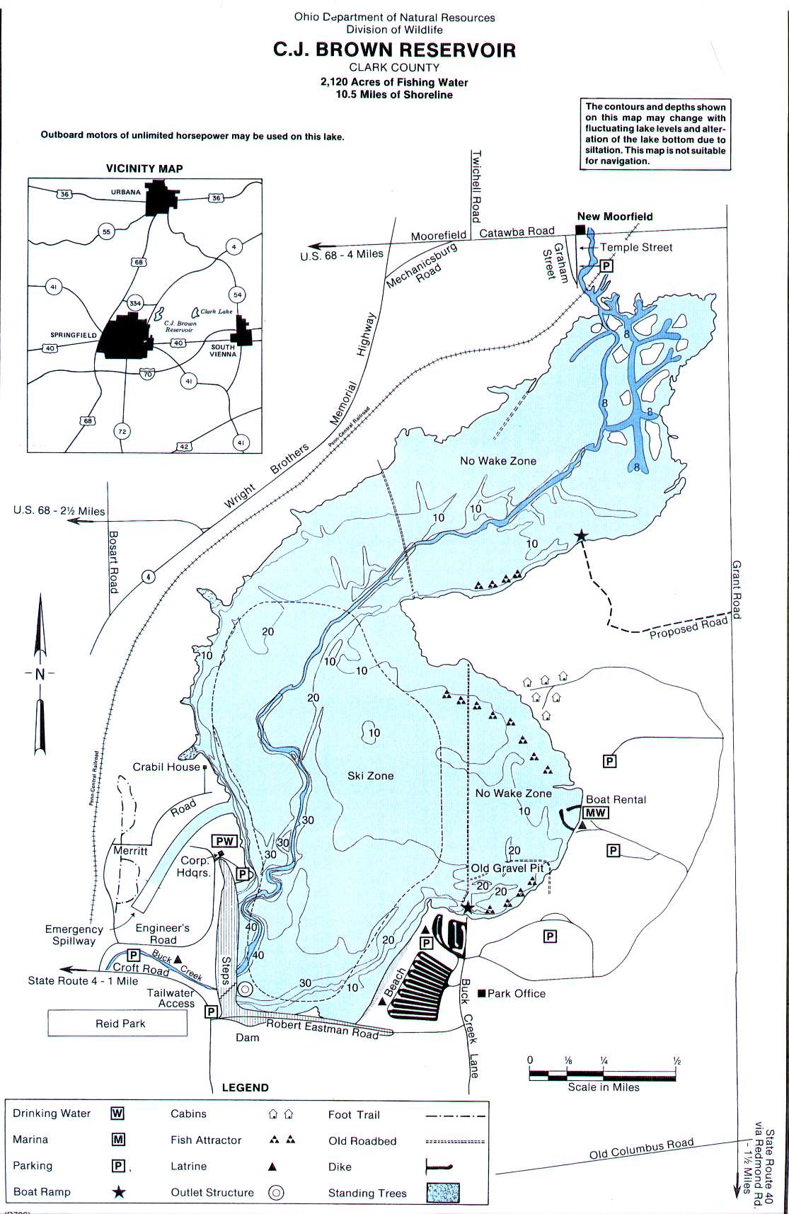 2120 acres
Unlimited HP
Clark Lake Fishing Map
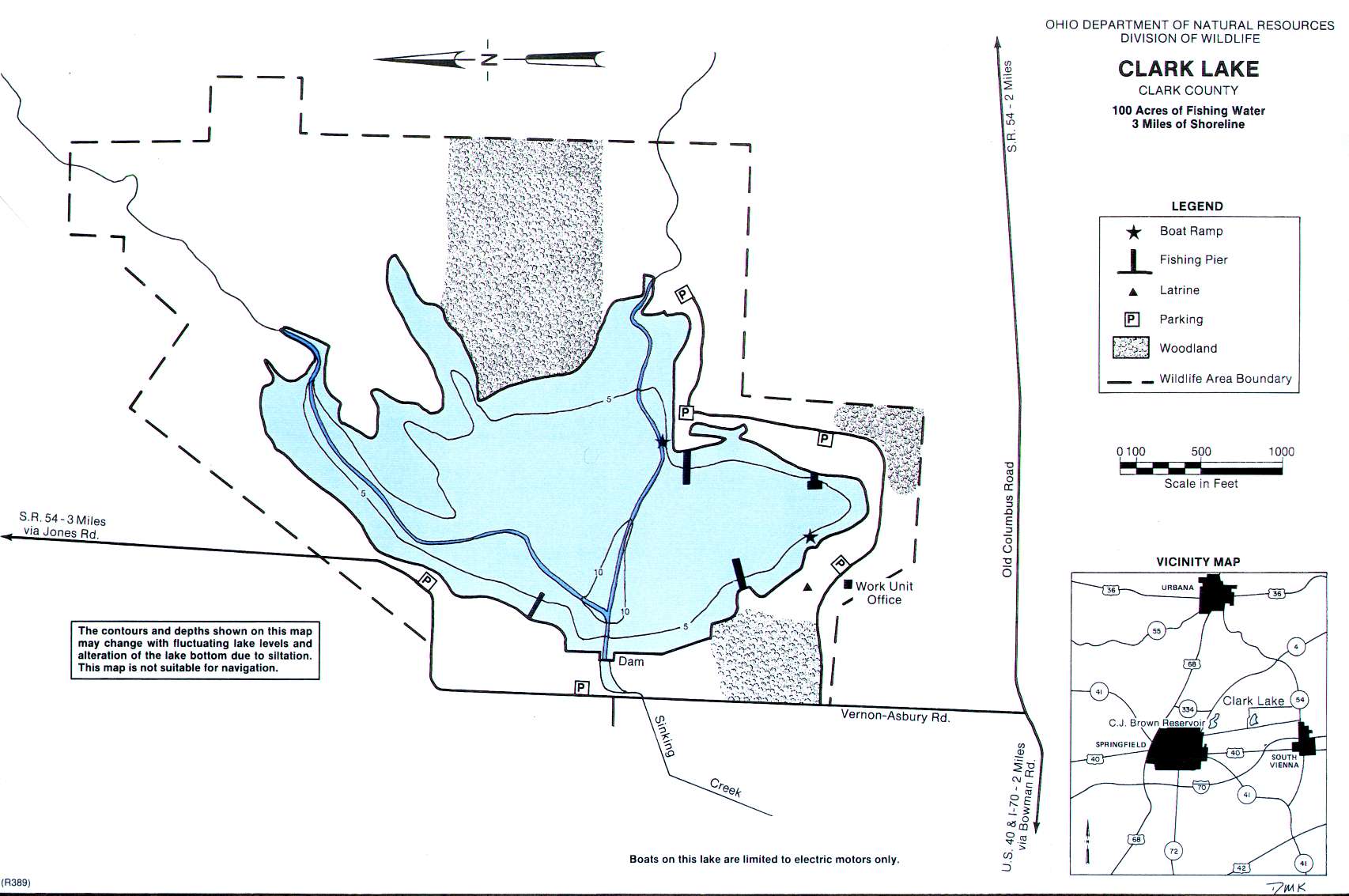 100 acres
Electric motors only
Cowan Lake Fishing Map
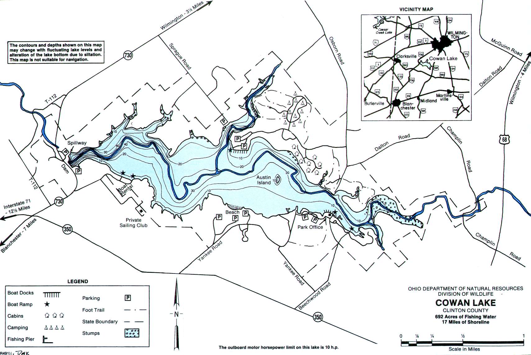 692 acres
10-hp limit
East Fork Lake Map
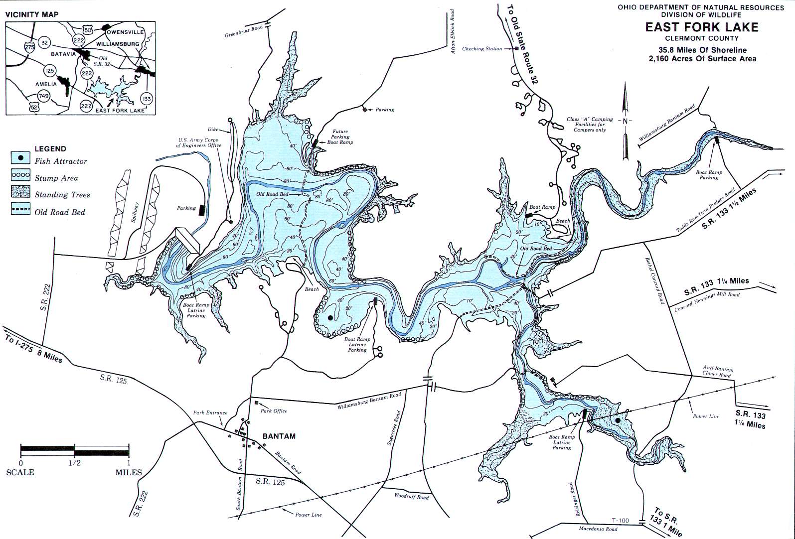 2160 acres
Grand Lake St. Marys Map
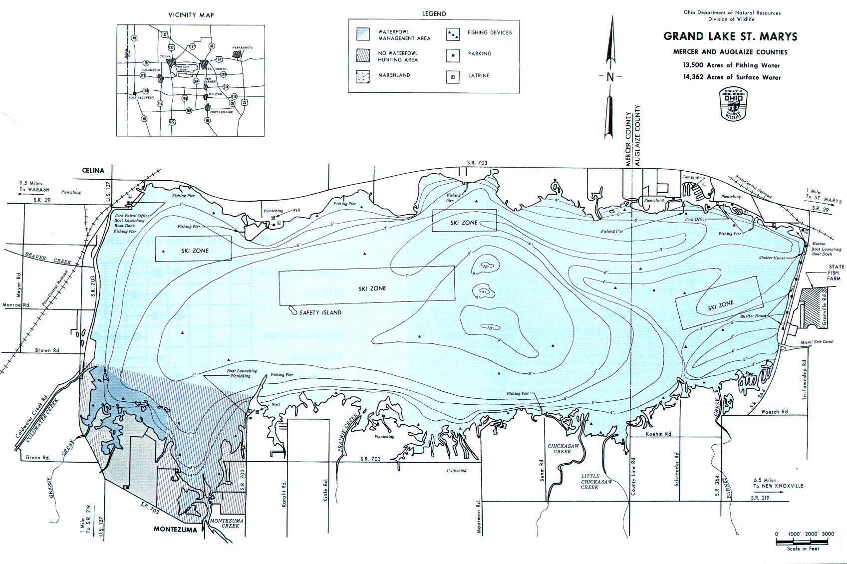 13500 acres
Unlimited HP
Lake Loramie Fishing Map
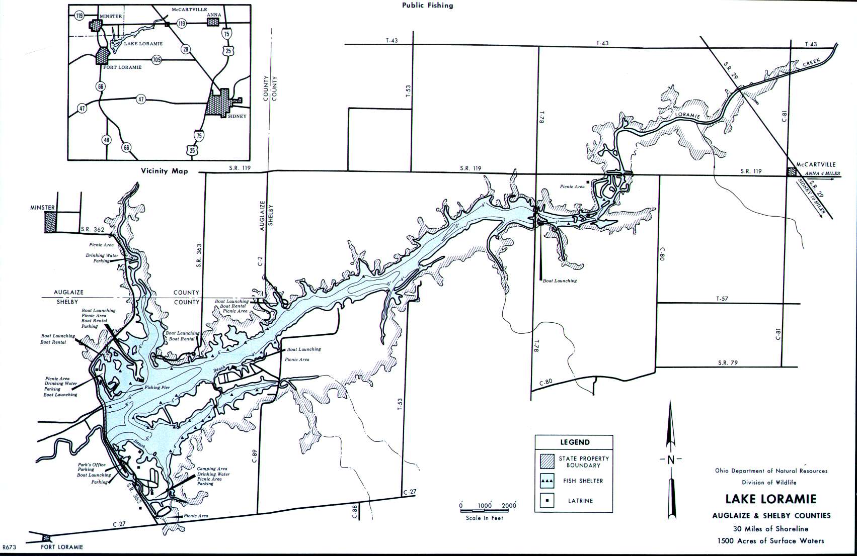 1500 acres
Unlimited HP
Paint Creek Lake Map
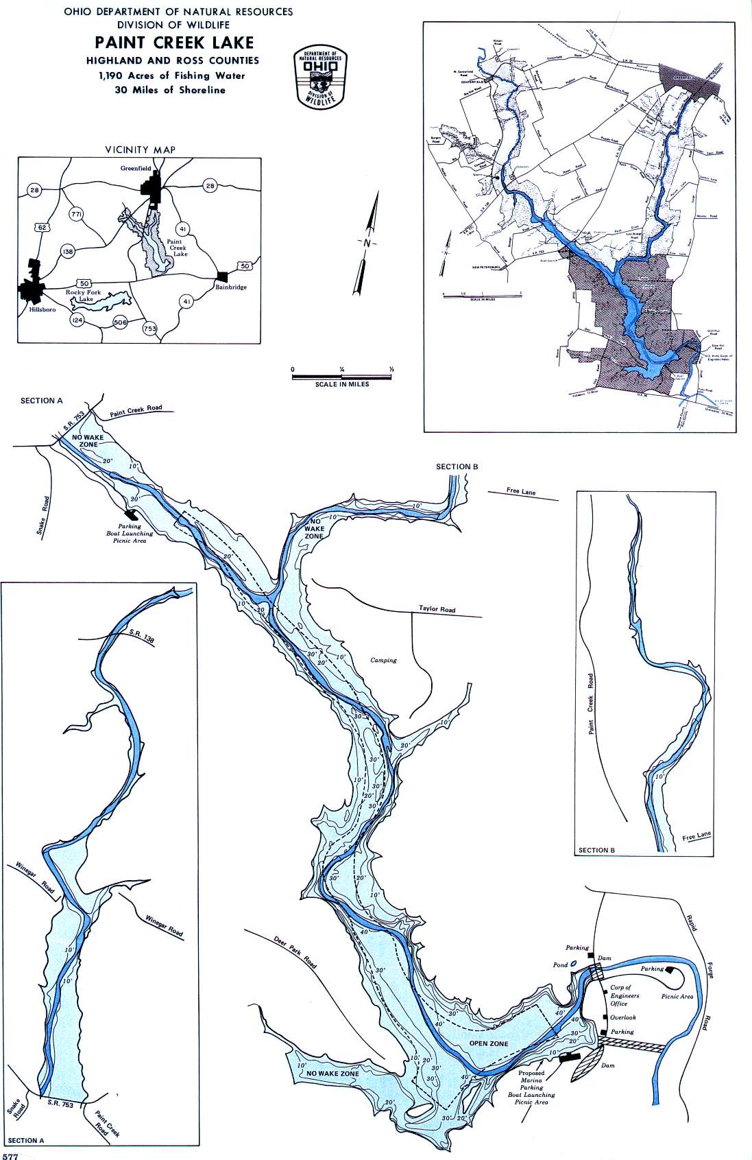 1190 acres
Unlimited HP
Grand Lake St. Marys Map
 13500 acres
Unlimited HP
Rocky Fork Lake Map
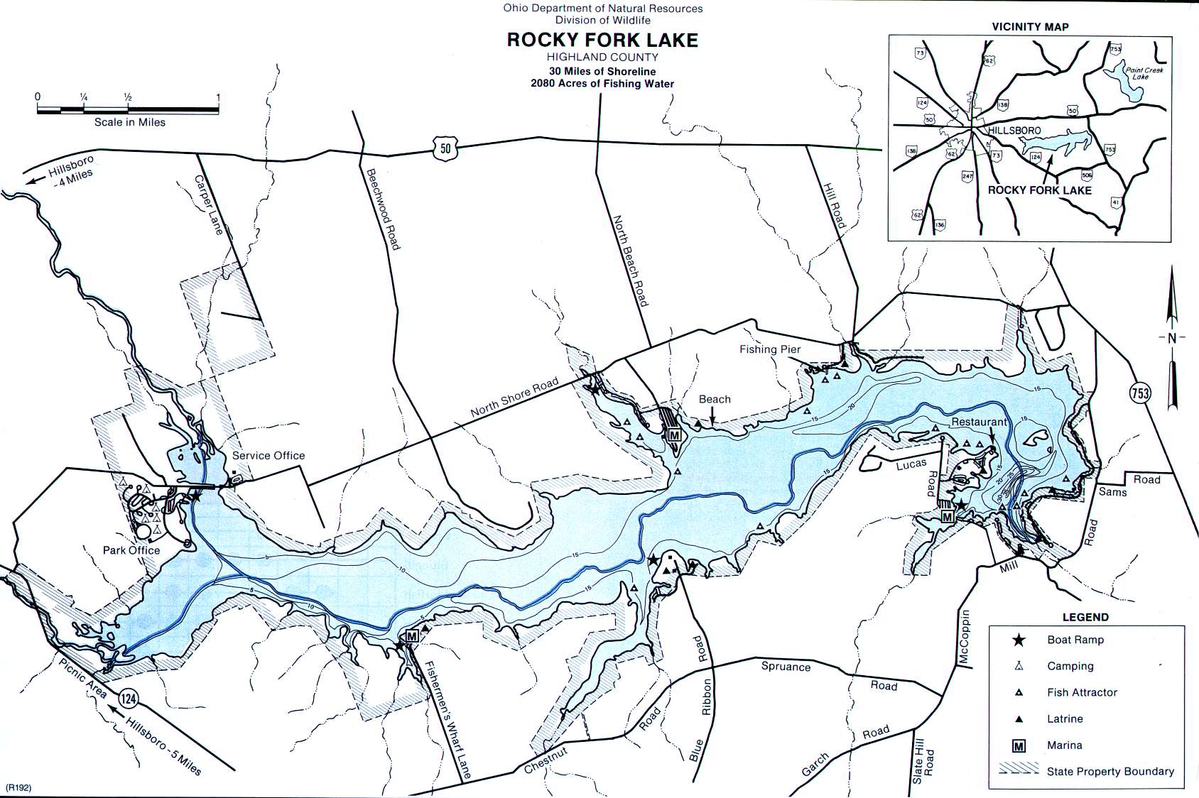 2080 acres
Unlimited HP
Stonelick Lake Fishing Map
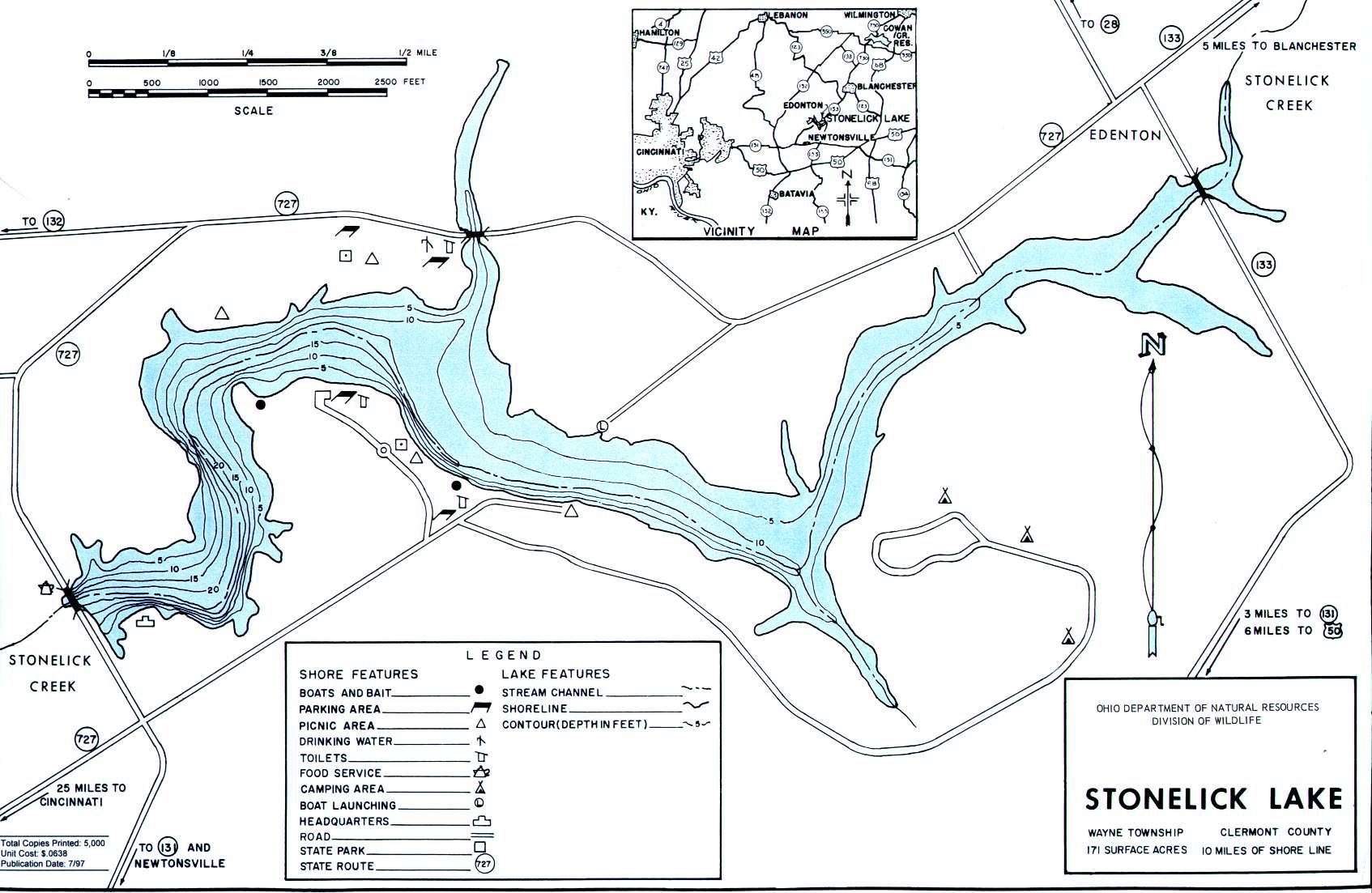 171 acres
Electric motors only
GFO Fishing Polls
 Loading ...


