Central Ohio Fishing Lake Maps - Region One(1)
Find Central Ohio lake and reservoir fishing maps for fishing locations around Columbus, Mansfield, Grove City, Marysville, and Delaware. Additional lakes are added to the listings as they become available. Ohio Division of Wildlife Offices are listed below. Please contact them with any concerns or comments that you may have concerning your favorite lakes!
Click Lake or Lake Name for more info ~ Tight lines from Team GFO!
Alum Creek Lake Map
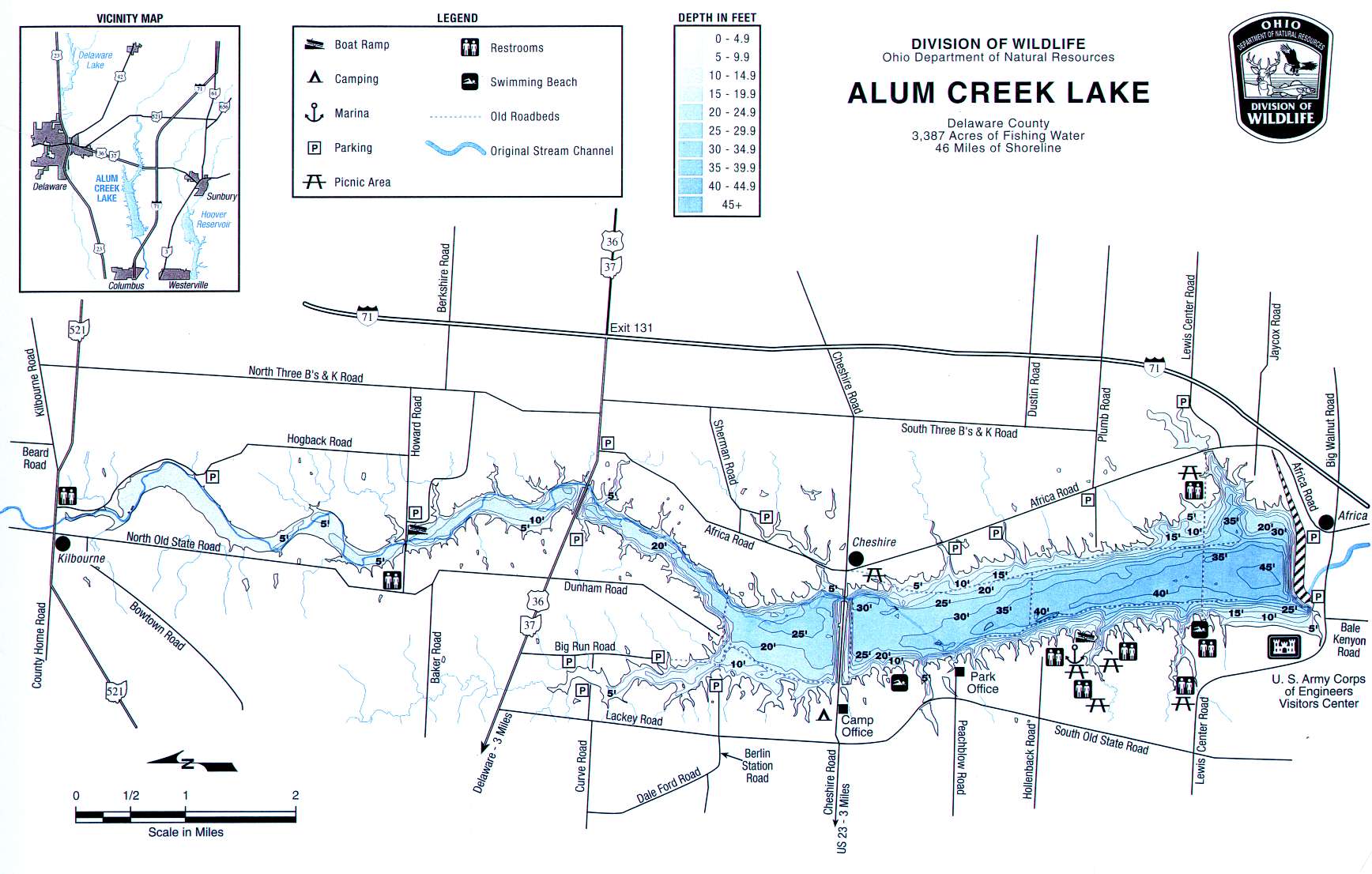 3387 acres
Unlimited HP
Buckeye Lake Map
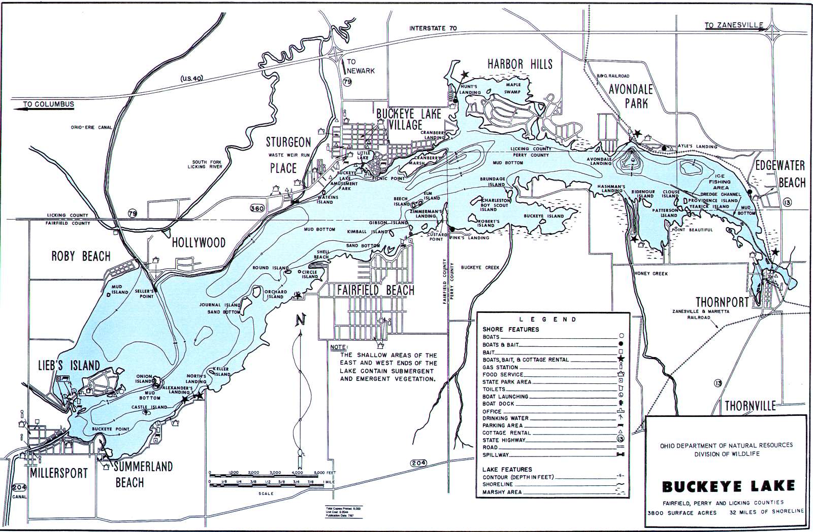 3600 acres
Unlimited HP
Clear Fork Lake Map
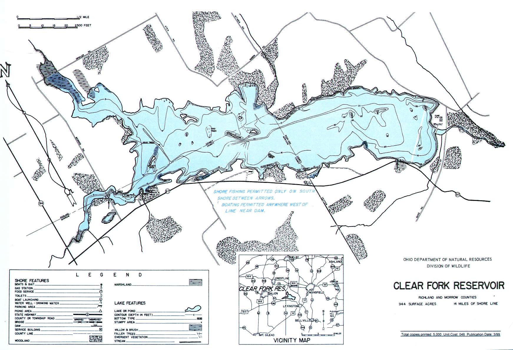 944 acres
10-MPH Speed Limit
Deer Creek Lake Map
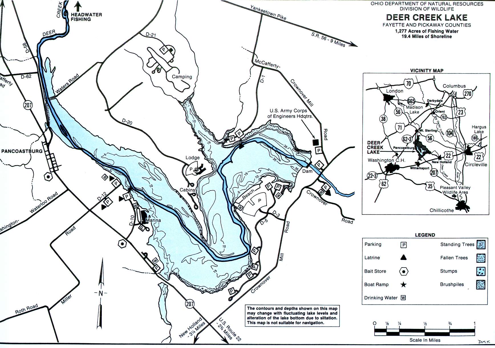 1277 acres
Unlimited HP
Delaware Reservoir Map
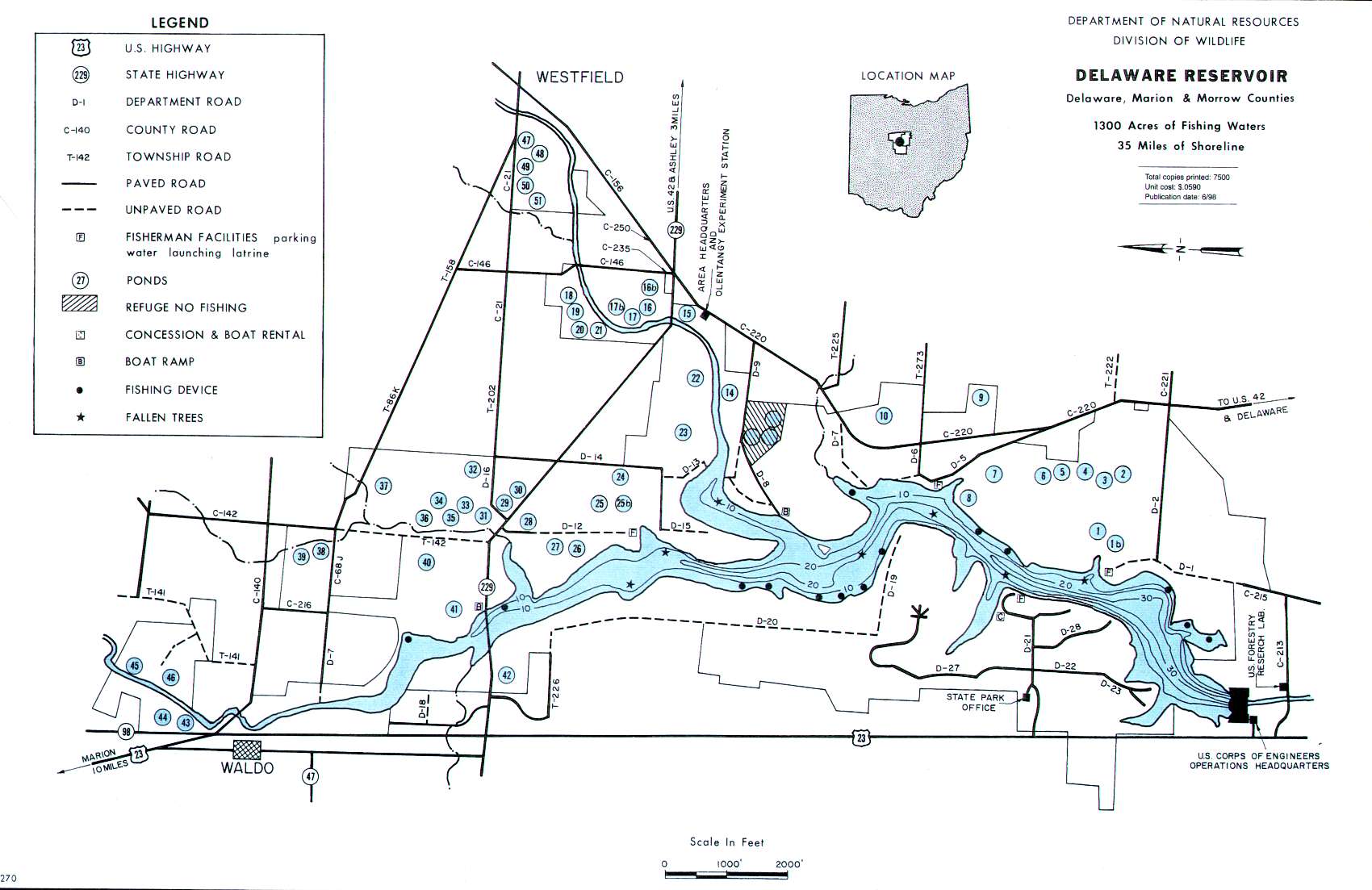 1300 acres
10-hp limit
Griggs Reservoir Map
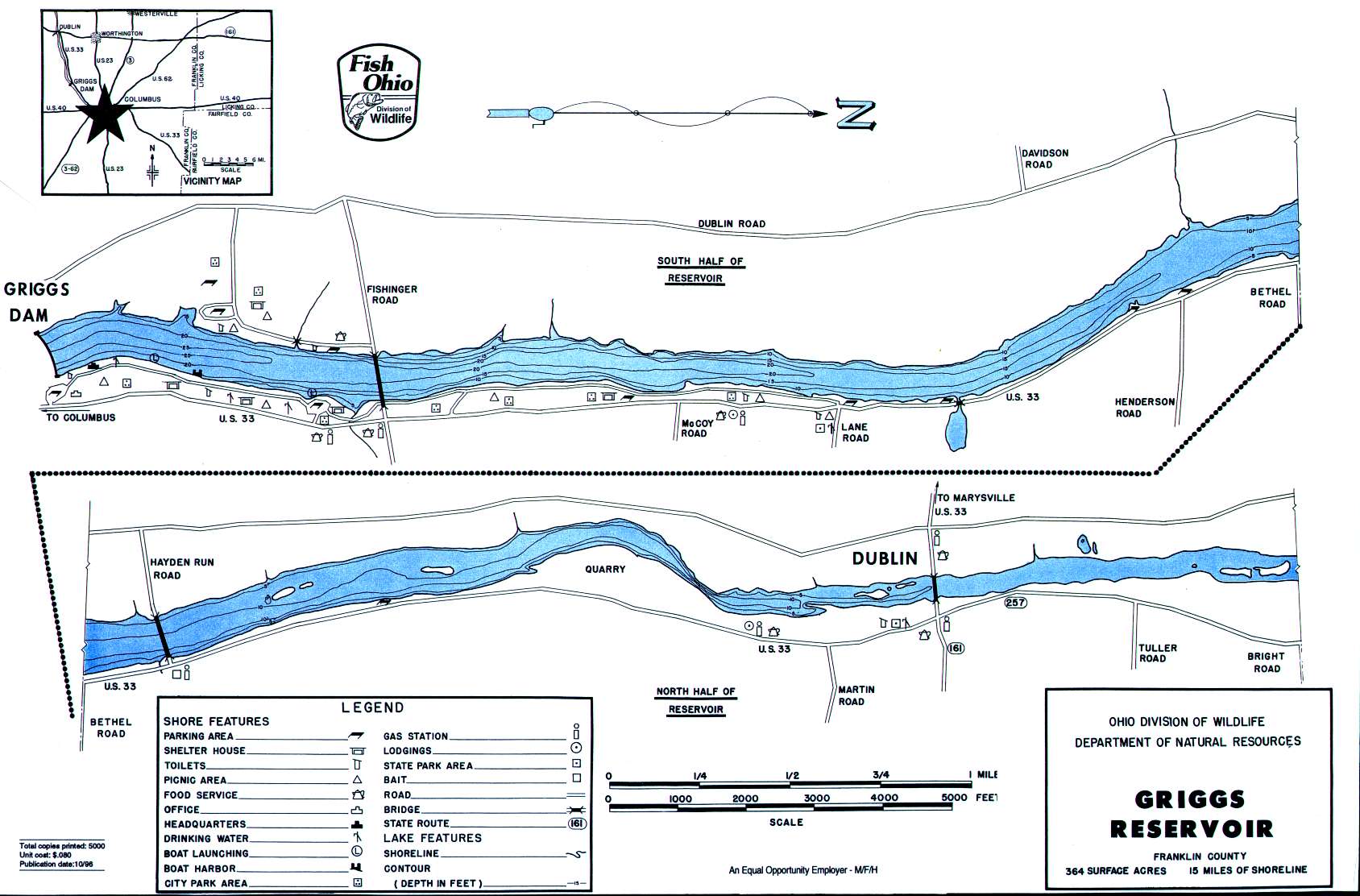 365 acres
Unlimited HP
Hargus Creek Lake Map
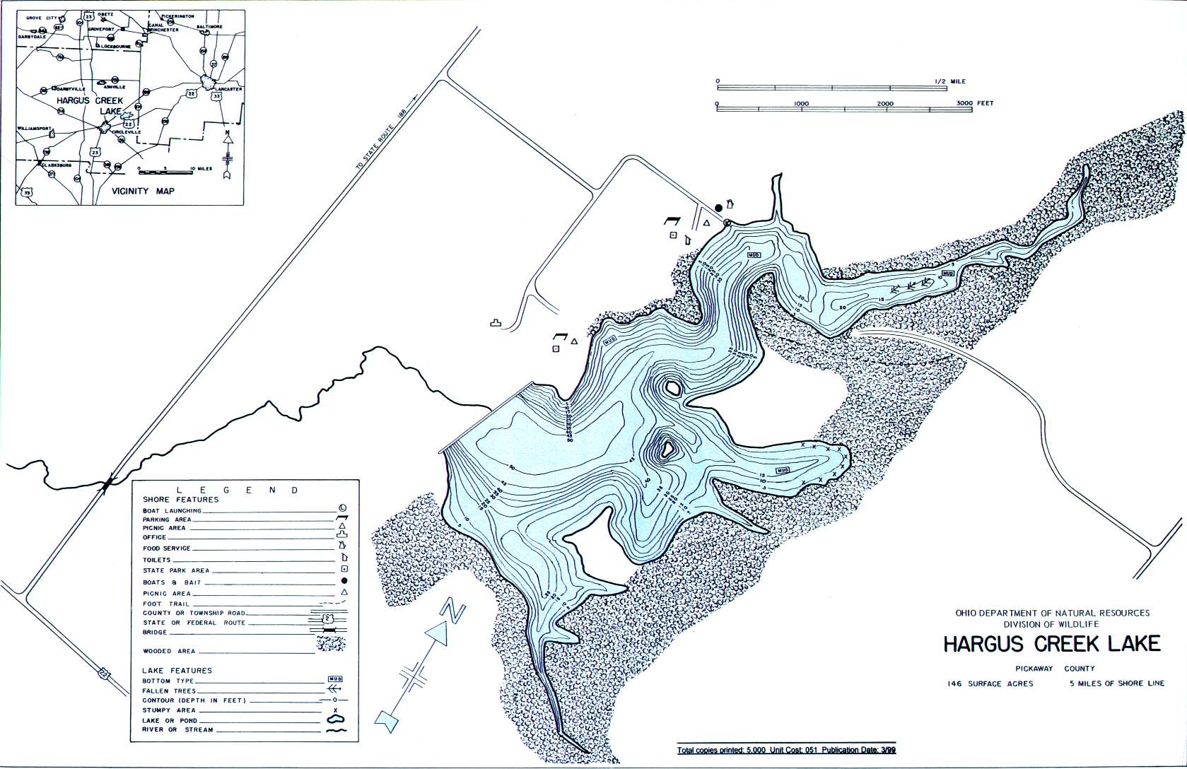 146 acres
Electric motors only
Hoover Reservoir Map
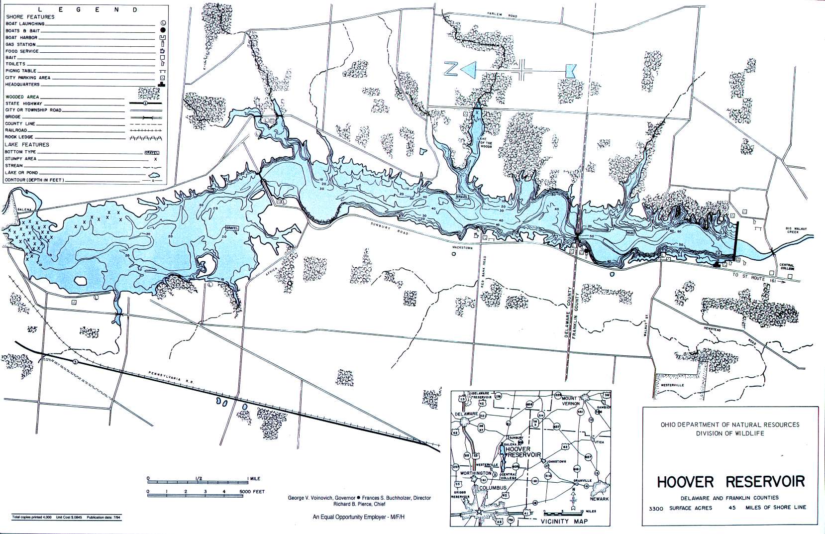 3300 acres
6-hp limit
Indian Lake Map
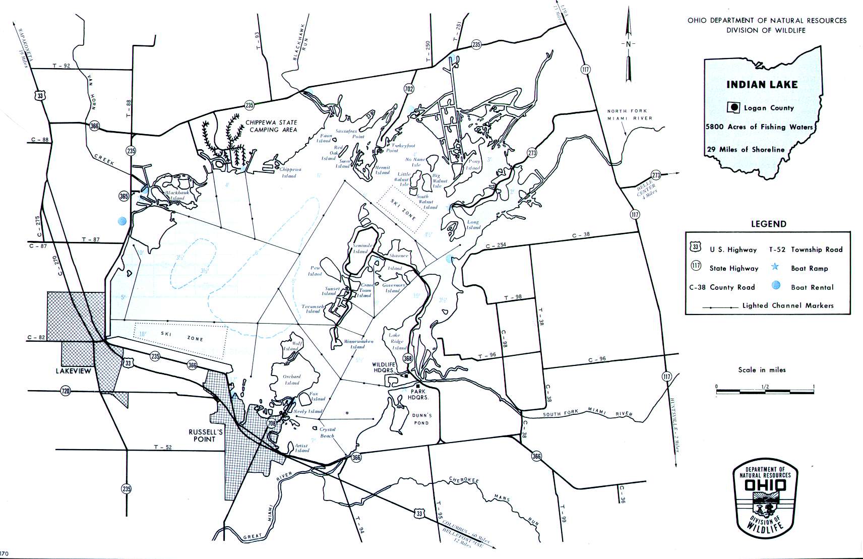 5800 acres
Unlimited HP
Kiser Lake Map
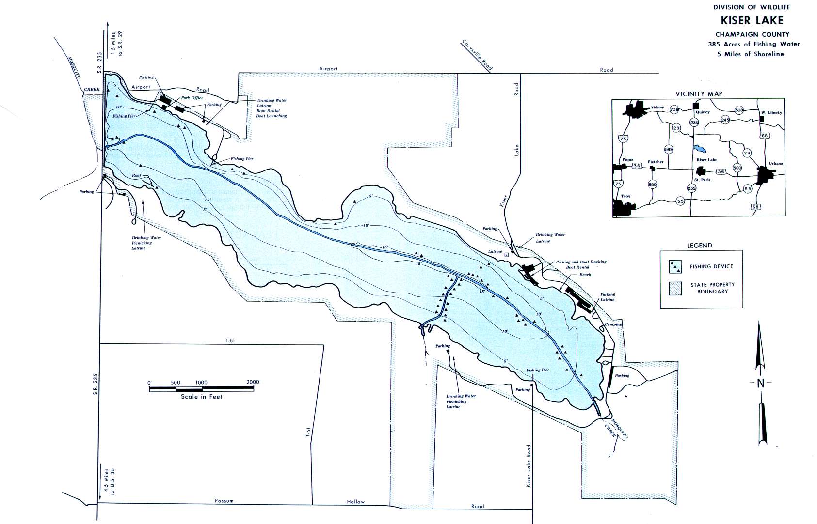 396 acres
NO MOTORS
Knox Lake Fishing Map
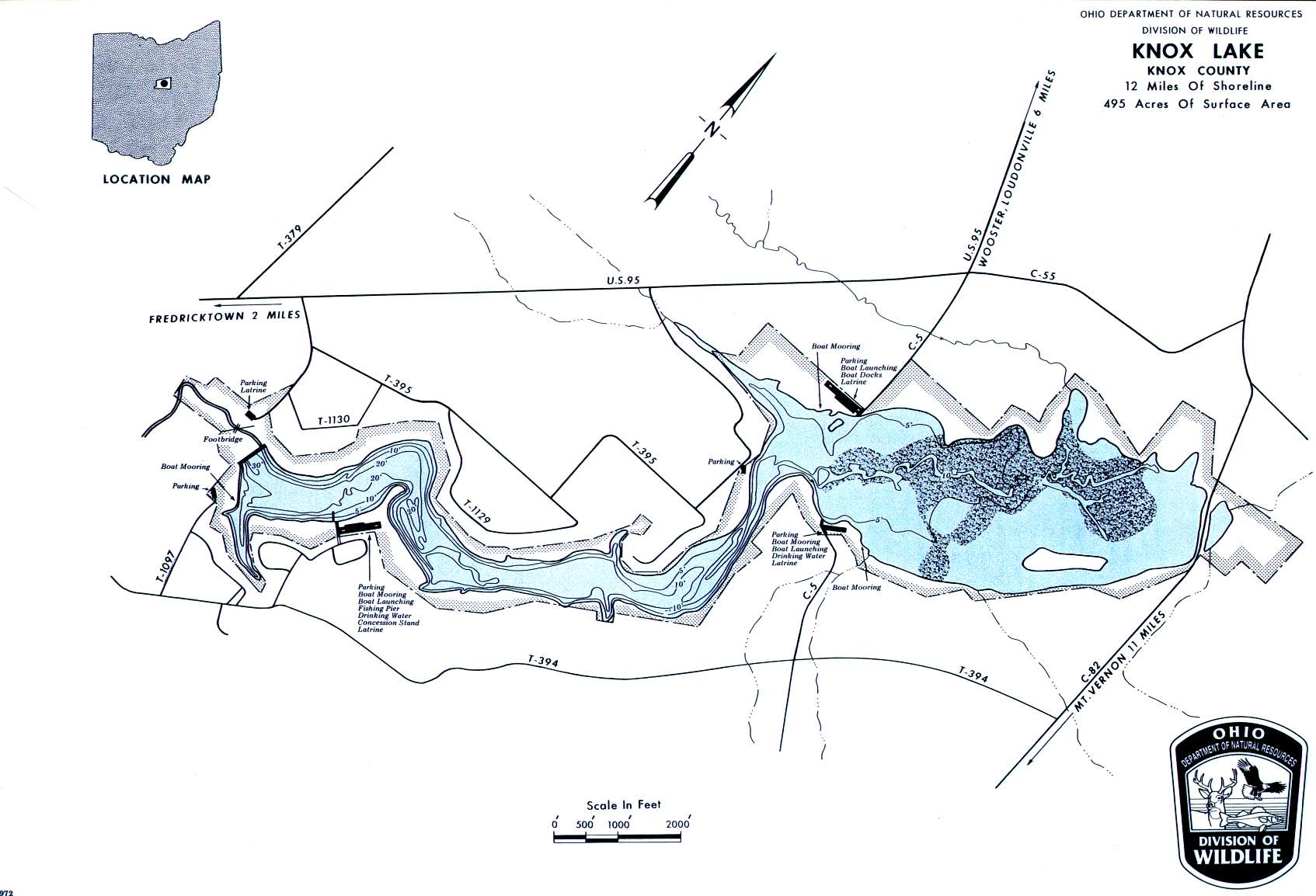 495 acres
10-hp limit
Madison Lake Map
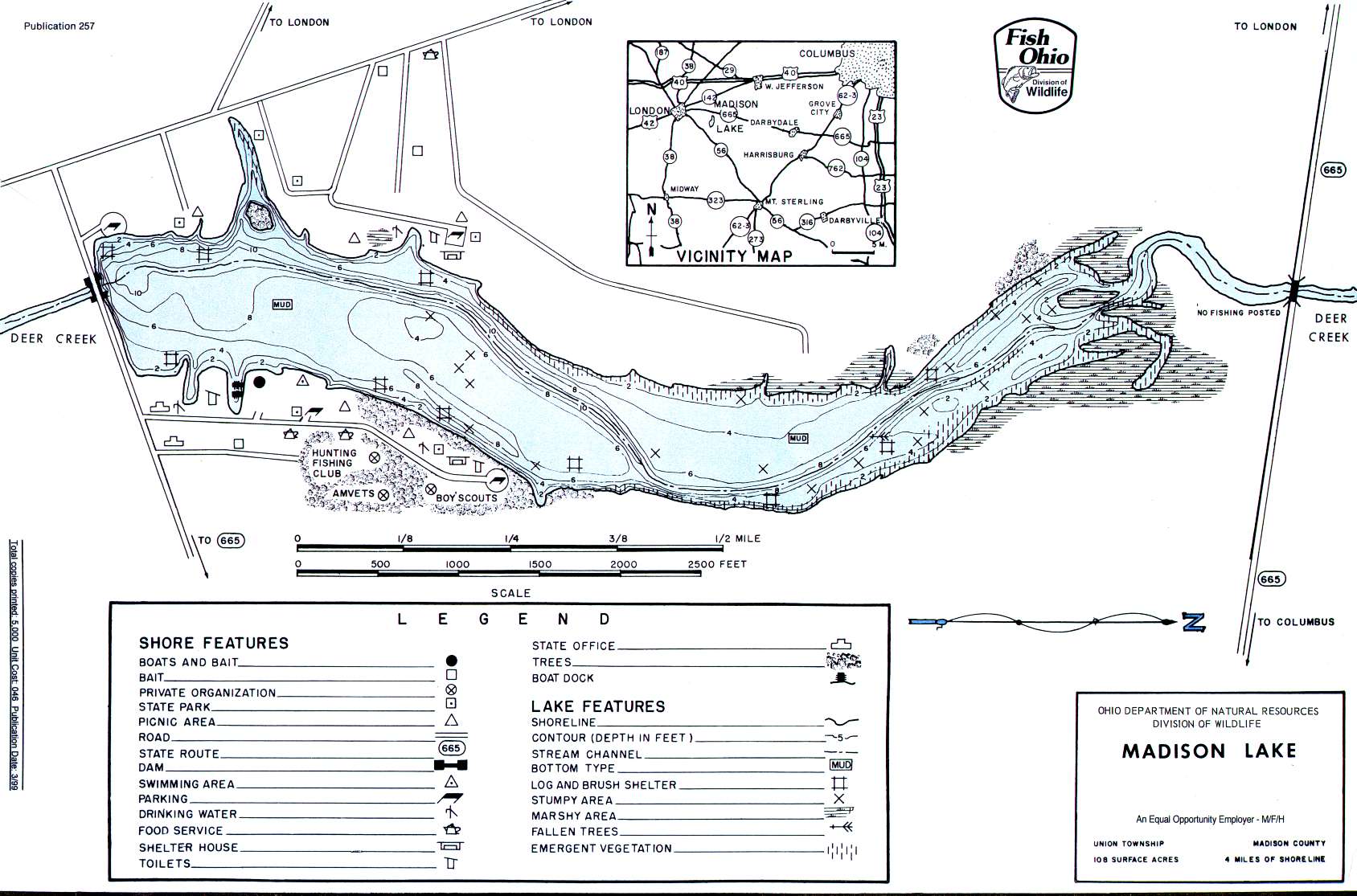 108 acres
Electric motors only
O`Shaughnessy Reservoir Map
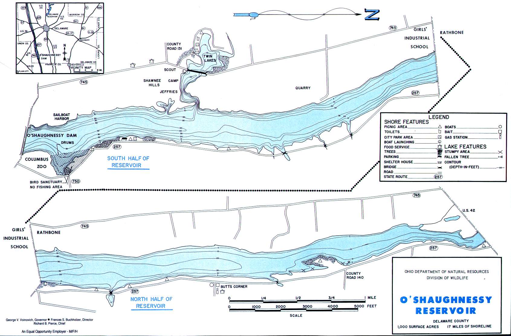 1000 acres
Unlimited HP
GFO Fishing Polls
 Loading ...

