Lake Info & State Management
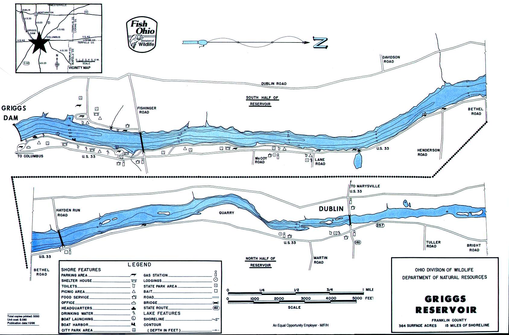
Griggs Reservoir is in Franklin County. This long and skinny reservoir covers 365 acres with 15 miles of shoreline. Ohio Division of Wildlife District One.
Griggs Reservoir is located between the cities of Columbus and Dublin and nearby Hilliard. It is located on the northwest corner of the Columbus area city limits.
Distance from Major Cities ~ Approximately 120 miles southwest of Cleveland — Approximately 90 miles northeast of Cincinnati — Approximately 55 miles east of Dayton.
Fishing Opportunities at narrow Griggs Reservoir include Largemouth and Smallmouth Bass * Crappies * Channel Catfish * Saugeye.
Boating Information ~ There are two primary boat ramps on the east side of the reservoir near the dam which can be accessed by Fishinger Road from US 33 or Dublin Road.
The Division of Wildlife activities include monitoring fish populations – stocking (mainly saugeye) -physical and chemical water analysis.
Griggs Reservoir ~ Google Maps
Ohio Adventures ~ (we went fishing!)
Lake Milton Bass Fishing Report
Spent some time yesterday out on Lake Milton for the first time this season. The past couple of years, I have been surprised by how far behind in vegetation growth it is in
LEWT Bay’s Edge Bait & Tackle Cast & Jig Results
After having to use a “blow day” for the original tournament date on Saturday, April 20th, 39 teams headed out to fish the event on Sunday. The MVP of the event was the Lowrance Live Target units, which helped
Turn In a Poacher (1-800-POACHER)
Ohio’s Turn In a Poacher -“TIP” program – helps to curtail poaching throughout the state by involving the public in reporting wildlife violations. If you observe a wildlife violation, click here and submit the form online or print the form and mail to:
TIP Headquarters, Division of Wildlife
2045 Morse Rd., Bldg G | Columbus, Ohio 43229-6693
Or call the TIP toll-free hotline, 1-800-POACHER.
